


Today viewed as the “Mare Nostrum” of the United States, the Caribbean Sea and the Gulf of Mexico were some four centuries ago the “Mare nostrum” of an empire on which the sun never set, that of the Holy Roman Emperor Charles V.
Towards the end of the 19th century, Alfred Thayer Mahan devised one of the world's most influential naval strategies, applicable to all seas. It was the Caribbean that was to provide the first test area of the military strategy of the emerging American power in the final years of that century. From the 15th century onwards, the construction of the political and economic entities of the Caribbean by the major powers historically initiated the process that brought the New World within the European realm. This was the veritable incarnation of ‘sea power' not just as command over the sea, but as the power of the sea.
It is the sea and its trade-winds that brought access to the first islands beyond the “Sea of Mists” for the navigators who followed in the wake of the expeditions of Christopher Columbus. It is from that same sea and its ‘westerlies' that came the returning ships, sailing towards the Azores, thence to the ports of Seville and Cadiz, or later to Bruges, Antwerp, Nantes, Bordeaux, Plymouth and Bristol - fleets laden with riches extracted, pillaged or produced in the New World. Navigation across the Atlantic, with its violent storms, was not without risk, but at the dawn of the 16th century it was far less hazardous than the African Atlantic and the route to the Indies around the Cape of Good Hope. The islands of the Canaries, Madeira and Cape Verde also provided staging-posts for both crews and ships for revictualling and repairs. At specific times of the year, seasonal winds opened up established corridors for fast crossings to the navigators whose accumulated experiences, recorded in marine charts and log books, produced the earliest understanding of the functioning of this great stretch of water that had been both obstacle and source of fear until the end of the 15th century. By the 18th century, English ships were taking 18 days to cover the 2 300 km between Plymouth and Madeira, and only 27 days to cross the remaining 5 000 km separating Madeira from the Lesser Antilles. Long before that, the Spanish, at first alone, then followed by the Dutch and French, had used the same naturally-facilitated fast routes that brought the new-found horizons and sources of wealth of the Caribbean archipelago within reach of European economic centres and, even more so, the American Continent.
From the very first explorations, precious metals, gold and silver, were the primary motivation of all new expeditions. Hispaniola had very little in the way of gold. From the first discoveries of the Conquistadores on the mainland, Spanish efforts in the exploitation and transportation of precious metals was organized primarily for their own benefit. After 1493, the two great maritime powers of the time, Spain and Portugal, sought recognition of their respective prerogatives overseas and lands discovered. Two papal bulls issued in 1493 did not suffice; it was not until the Treaty of Tordesillas in June 1494 that a demarcation line established 370 leagues to the west of the Cape Verde Islands confirmed the integration of the land of Brazil within the Portuguese orbit.
Spanish supremacy over the Caribbean Sea and the colonial southern sea route lasted throughout the whole of the 16th century, but from the earliest expeditions onwards this would be contested. Attacks waged by privateers, as well as piracy, was to continue over the next two centuries. The control of seaways, strongholds and strategic positions constituted the basis by which the balance of power was decided in the Caribbean Basin. Other parts of the world faced similar confrontations, but the Caribbean was particularly intensely affected.
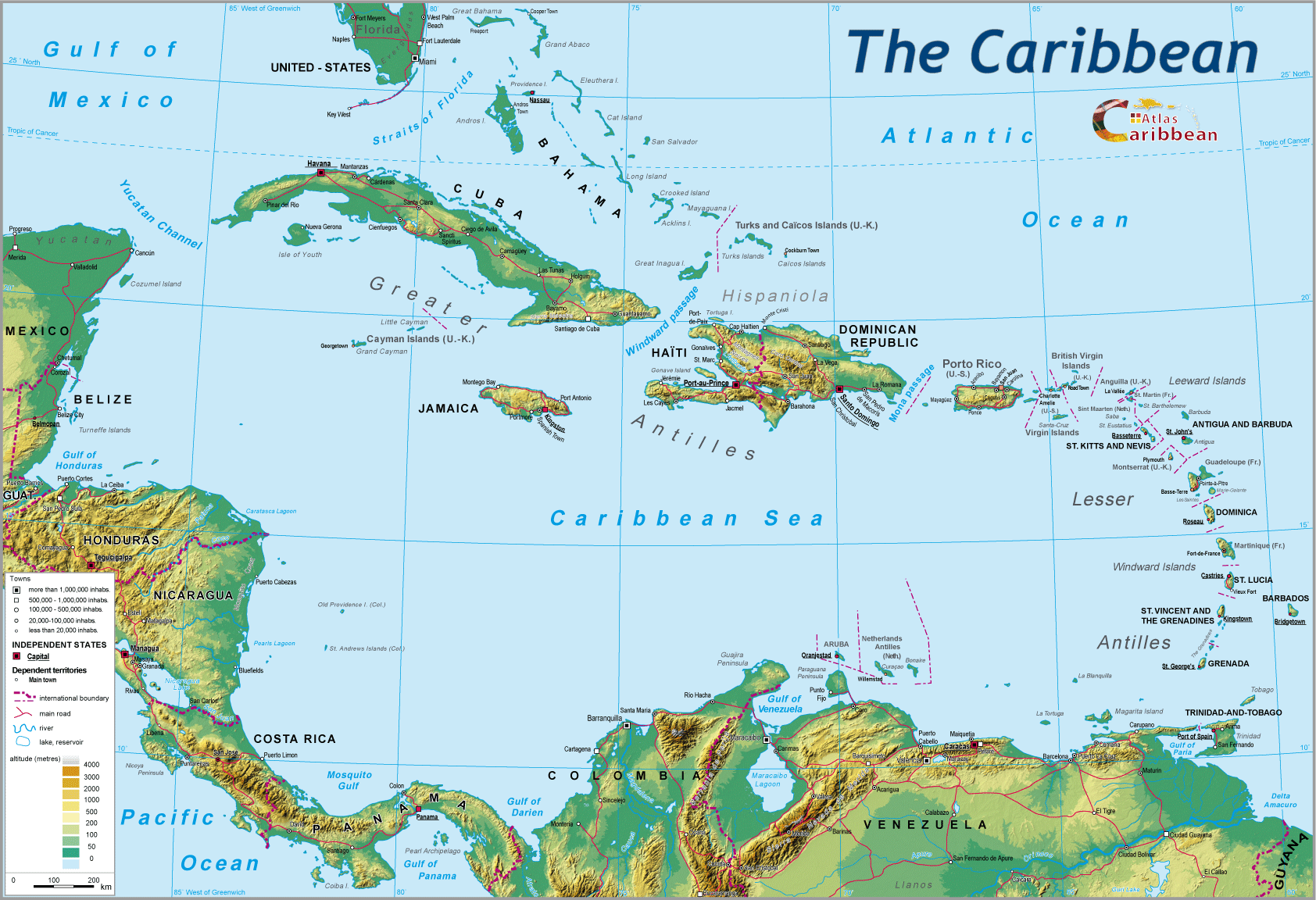
During the early period of Spanish settlement of the Greater Antilles, the fleet would set out annually from Cadiz for Hispaniola, from whence ships would continue to other colonies in the process of being established. Following the conquest of Mexico and Peru, the ‘Casa de Contratacion;' sent further fleets from Seville and Cadiz. These entered the Caribbean Sea via the passage separating the Virgin Islands from Puerto Rico. One section sailed towards Veracruz in Mexico, stopping over at Puerto Rico, Hispaniola and Cuba, the other ‘Galleones' were routed towards Cartagena and the mainland, meeting up with expeditions returning from Peru. The “Southern Armada” delivered its precious cargo from Lima to Panama having effected a land crossing of the isthmus by caravan as far as Porto Bello. Havana provided the final gathering point, then onwards, via the Bahamas Channel, the fleet headed back to Seville. Thus was completed the so-called Spanish “Volta,” which brought to the Kingdom of Spain, and then the Empire, the vital flow of gold and silver. From Spain, it would bring economic benefits to the whole of Europe. In order to safeguard both routes and cargo, strongholds were established. Cuba acquired its strategic position, Havana becoming “the key to the Indies.” Many decades later, in 1763, after England seized Havana from Spain, William Pitt was to declare: “Since its capture, all the riches and treasures of the Indies lay at our feet.” Spain constructed a huge fortress at Cartagena; Puerto Rico, Cuba, Cartagena, provided but a few of the nerve points in a total system controlling the seas and navigation routes. In turn, these would remain repeatedly at stake in the struggles between European powers in the Caribbean.
In these seemingly endless conflicts, punctuated by acts of piracy and the use of “letters” by privateers, securing the seaways and points of entry into the Caribbean became the key to overall control. The progressive weakening of the Spanish Empire by its competitors was played out year after year at sea. It would be further driven by the development of colonies where the Spanish Kingdom's hold had never been strong - the Lesser Antilles, the Guyanas and North America.
After Richard Hakluyt, advisor to Elizabeth I of England, on whose ideas the whole English project of imperial expansion was based, Oliver Cromwell following the Navigation Acts of 1651, launched an expedition to the Caribbean in 1655, which he named his ‘western project.' The logic of controlling ports and sea passages was extended to cover the whole Caribbean. In the 1720's, the English took possession of Saint Thomas and Crab Island in order, according to the governor of the former, to encircle Puerto Rico so as to take possession of it at the first rupture in relations with Spain. Amongst the many conflicts of the same order, those relating to the tiny Turks Islands would involve the most resistance in the battles for these sea strongholds. The Turks, the last links in the chain of the Bahamas, admittedly tiny islands, nevertheless occupy a key position controlling the opening of the windward passage between Cuba and Hispaniola. Long contested, they would be finally come to be held by England.
The battle for control of the seaways did not stop at the shores of the Caribbean. It was pursued relentlessly in the search for a passage between the two oceans; the great and grandiose enterprise to connect by canal the Atlantic Ocean with that expanse that Vasco Nunez de Balboa, at the end of a 25 days march in 1513, had sighted from the summit of the Sierra de Quaregna and named the ‘Southern Sea.'
Portugal and Spain mounted rival expeditions to discover the sea passage eastwards, the other route to the Indies - that which Columbus had already tried to find and early navigators had long sought beyond the ‘Terra Australis Incognita,' without knowing precisely what distances remained to be covered. The Venetian, Verrazano who, in 1533, had journeyed the entire length of the North American coast, from Florida to Newfoundland, published an admirable report but one which failed to cite the discoveries of Balboa (1513) or Magellan (1519–1521).
Magellan, benefiting from the contributions of several previous expeditions, drew on the maps of the German geographer Martin Behaim suggesting the location of a possible passage. Magellan reached this passage in October 1520. It then took him a month to navigate through and emerge onto the immense ocean, which he then crossed at one go, benefitting from the surprisingly calm weather conditions that led him to name the sea “Pacific.” The difficult rounding of the South American continent prompted the demand for an alternative route. In the explorations of succeeding expeditions the craziest projects were mounted to find or, failing that to construct, a link between the two oceans.
The first of these ventures emerged shortly after the end of the Cortez conquests of 1520 and 1530. They continued for nearly four centuries: 400 years of tracing rivers back to their sources, traversing forests and mountains, of travel journals and reports, of supplication and argument. The most frenzied competition between the great powers prevailed, this time for the control of the passage between the two oceans. Inevitably the Kingdom of Spain was at the forefront in these diverse projects. Having completed the conquest of Mexico in October 1520, Cortez informed Charles Quint of the possibility of a passage between the river Coatzalcoalcos, the Chimalaya and the Gulf of Tehuantepec. A few years later, representatives of the Crown in what is now Nicaragua reported that Gil Gonzalez Davila had discovered the existence of a link running between the inland lake of Nicaragua (some 160 km long and ending only 19 km from the “other side,” today the Pacific Ocean), and the Caribbean Sea, by way of the river Desaguadero (today the river San Juan) which was navigable along its whole length of 210 km.
In 1520, i.e. during the same decade, Saavedra proposed a crossing of the Darien Isthmus in what today is Columbia. The Portuguese were not far behind in this race to reach the other ocean and envisaged routes across the Isthmus of Tehuantepec, or Panama. These four possible routes, the Isthmus of Tehuantepec, Isthmus of Darien, Panama and San Juan–Lake Nicaragua would one by one, or simultaneously, be considered and explored, the targets of often very violent expeditions and conflicts which the actual existence of the Panama Canal today has largely eclipsed.
Of all the routes envisaged, it was the one traced across Nicaragua that was most coveted and commanded the longest attention. In 1748, the English took San Juan del Norte, located where the mouth of the San Juan River runs into the Caribbean Sea. Several further expeditions followed throughout the 18th century until in 1849, Britain took control of the bay of Fonseca, the potential outlet into the Pacific of the eventual canal.
The quest for a passage linking the two oceans mirrored the pattern of confrontation for influence between the great powers. The British challenged Spanish supremacy, and prevailed; an emerging American power, from its very first steps affirmed its presence. The first contract relating to a transisthmic canal was negotiated and signed in 1826. During the same period, the French and the Dutch did not relinquish their claims and in 1829, William I of the Low Countries obtained rights to excavate from the Nicaraguan government. French initiatives at the time testify to the astonishing memory of Louis Napoleon Bonaparte, the future Emperor Napoleon III, in a tract written while in prison, entitled “Creation of the Nicaraguan Canal, or project for linking the Atlantic and Pacific Oceans by means of a canal.”
The United States had by now become more and more significant important as treaties, expeditions and concessions followed one after the other. In the John Hay/Herr Treaty of 1903, Columbia accorded the United States a 100 years renewable right to construct and manage a canal. The following year, the French concession in Panama was bought back. Regardless of this, the Nicaraguan project was not dead and in 1914, during a military intervention, the United States obtained the right in perpetuity for the construction of a canal. The incessant pressure by the external powers to breach the barrier of the Isthmus and to control the passage through it had not let up in nearly four centuries. The Panama Canal, opened in 1914, remained an American concession until its return to the Republic of Panama on 1st January, 2000, under the terms of the 1977 Torrijos-Carter Treaty.
This particular undertaking, as with the progressive arrival and then pervasive presence of the United States in both the Caribbean and Latin America, was evidence of the growth of a new power, in which James Monroe and Alfred Mahan would prove to be key players. During the 19th century, the territorial construction of the United States, the abortive Southern Caribbean dream, Pan-Americanism in opposition to the British imperial power, and the emergence of an American hegemony were inter-locked within the Caribbean arena.
James Monroe was the author of the purchase of Louisiana in 1803. For 60 million gold Louis, the United States advanced across the Mississippi, acquiring 2 million square kilometres and effectively doubling their territory, which already stretched as far as Canada. In time, the United States would confront Britain and Spain. Louisiana represented the first gateway to the Caribbean and one of the final clashes between the United States and Britain took place at New Orleans in 1812 over the question of ‘rights of neutral parties.' This battle saw advantage switch to the young general Andrew Jackson, the same man who would occupy Florida in 1818 in less well defined circumstances. The policy of ‘fait accompli' forced territorial concessions from Spain for five million dollars, opening the United States second gateway to the Caribbean.
The ‘rights and interests of neutral parties,' represented the American refusal to entertain any intervention on the part of imperial European powers, not just within the United States but also across the whole continent and constituted the basis of the declaration, drafted by John Quincy Adams, made in James Monroe's Presidential Address to Congress on 2nd December 1883 (it was not yet referred to as the ‘Monroe Doctrine,' a title that appeared for the first time in 1854). It was to progressively shape the legitimacy of American Continental policy.
The opening of a third gateway to the Caribbean, via Texas, was closely linked to the growing influence of the Southern States. The annexation of Texas resulted primarily in the emergence of a continental economic system of development, one of large scale, slave-labour based cotton plantations. At the same time, the American ring-fencing of the shores of the Caribbean gave impetus to the expansionist dreams of the South. To the south of the ‘Mason & Dixon Line' slavery and the cultivation of cotton expanded. Extension westwards raised concerns for plantation owners who saw a risk of a political imbalance developing within the Union. In response, they developed an annexationist policy leading to the de-facto occupation of Texas before its official annexation in 1845. In 1844, John Quincy Adams was already worried by this development: “the annexation of Texas (...) marks the first stage towards the conquest of Mexico and the Antilles by a freedom-suppressing, slave-owning, colonising, maritime monarchy.” It remained true that the southern dream consisted not only of counter-balancing the states lying to the north of the ‘Mason & Dixon Line,' but also of extending the South's hold over the whole of the Caribbean Sea and its surrounding perimeter, with the aim of becoming both a maritime and land power, ensuring its commercial growth and prosperity. Though President Polk (1845-1849) did not share the southern dream, he nevertheless declared that he was “resolutely in favour of the purchase of Cuba to make it one of the states of the Union.” He subsequently made numerous attempts to buy Cuba from the Spanish Crown and Cuba once again found itself at the epicentre of a power struggle within the Caribbean. The American South's dream in its initial form, waned with the defeat of the Confederates, but regained shape under the impetus of a subsequent broader imperialism progressively pursued by the United States.
The Monroe Doctrine, from being a defensive measure, went on the offensive. This early imperialism firstly expressed itself in the form of Pan-Americanism. Havana became one of the first places to feel its impact in 1898 when Alfred Thayer Mahan derived from the Hispano-American war, and the situation facing the Caribbean, the essential elements of the naval doctrine that would be adopted by the young American power. The blowing-up of the battleship “Maine” in the port of Havana led to a three month war with Spain and at its close the United States annexed Puerto Rico and Cuba became independent under American tutelage as defined by the Platt Amendment of 1903. It is from this treaty that the surprising American possession (continuing to the present day) of the base at Guantanamo dates, leased for 5 000 dollars in 1912. The loss of Cuba and of Puerto Rico brought to an end the era of a Spanish ‘mare nostrum,' of which only a few tiny remnants remained in the aftermath of British domination; the papal division of 1493 was finally null and void. The era of an American ‘Mediterranean' was now underway.
This was the moment chosen by Thomas T. Mahan to draw major strategic lessons from this conflict. This friend of Roosevelt was one of America's advocates of a mainstream movement of ideas linking navalism and imperialism, much in vogue during the period 1880-1914. ‘Lessons of war with Spain' translates within a military and naval logic an idea that had been circulating for 50 years within the American ruling classes. Briefly, Mahan viewed Cuba as a necessary forward position in the defence of the United States. The proximity of the mainland already invoked by Quincy Adams reinforced the need for a ‘security bolt' closing the sea approaches, a tactic adopted since the time of Charles V and later challenged by William Pitt. The Caribbean thus becomes the ‘mare nostrum' of the United States. The departure of Cuba from the protection of the American realm after the Cuban Revolution, fired a resounding canon blast across the clear skies of American domination; it was, and remains, the greatest rupture to have affected the region. The 1958 revolution plucked the rotting fruit of the Batista regime at the very moment of its decline when it was already despised by the large majority of the population. For the previous half century, Cuba had been the closed preserve of the large American sugar corporations.
Revolutionary Cuba could only define itself in terms of total opposition to American imperialism. Anti-imperialist, nationalist and revolutionary in origin, it required only the multiple aggressive acts of the United States right up to the astonishing episode of the ‘Bay of Pigs' to push the young regime closer to the USSR, culminating in the missile crisis in 1962. From the notion of a forward defence, so dear to Alfred T. Mahan, Cuba became a hearth of opposition during two decades and progressively isolated as the Castro regime evolved.
A century had passed since the establishment of American influence over the Caribbean, the century of Mahan, Monroe and Roosevelt. This hold would, however, not translate into a total blotting out of European influences. The complex history of relations between colonies, both past and present, and their old European capitals still impacts on the life of the Caribbean. The United Kingdom has long maintained strategic interests in the region, even after the wave of Independences granted during the 1960s. The primary logic remains that of the security context in relation to maritime surveillance of the main sea-lanes and trading outlets: British Honduras, (today Belize) the western coast of Nicaragua, Guyana, Trinidad and Tobago, cordoning off the Antilles arc as well as controlling access to and from the Orinoco estuary. Further south, well beyond the Caribbean, the island arc between Argentina and the South Pole, on the route to the Pacific, also requires patrolling. In Kourou in Guyana, France has established a European version of Cape Canaveral. Two of the most important rocket launch sites of the present space age are located around the Caribbean basin. In recent decades, managing the security of these waters has proved to be a sensitive issue. The end of the 20th century brought it to the top of a global agenda, an imperative which remains both an American and international preoccupation around the seas of the Caribbean.
Above all, this preoccupation targets drug trafficking and money laundering run from ‘offshore' banking havens, two perniciously destabilizing activities that flourish across the Caribbean. Smuggling has been part of the Caribbean landscape for several centuries. Today, however, all other such trafficking is overshadowed by the most deadly and lucrative of trading, that of drugs. The vast credit-worthy market provided by the United States in such close proximity to countries still with low levels of living, in addition to the means to supply the raw materials for drug-making provides a permanent incentive for continuing this poisonous trade. Using all possible routes and means of transport, drugs arrive from both Central and South America destined principally for the United States, and secondly for Europe.
As American society has grasped the plague-like proportions of this trade, controlling the seaways and access points has become a major security imperative. The total annual value of this trade is stupefying, estimated at 2 500 billion dollars, nearly 10% of global commerce, the equivalent to the total sales of the world automobile industry. It generates colossal sums of money which the cartels can no longer ‘launder' like the Columbian Gacha of the Medellin Cartel had previously done in the 1980s (when using buried plastic sacks, a sudden rise in water level disbursed a welcome bonus to the local population!). Money laundering itself became a mainstream activity directly linked to the drug trade. The rapid internationalization of the money markets involved, together with new means of electronic exchange, introduced a further global dimension. This accumulation of power, its capacity to make or break governments, impacted sufficiently on the internal governance of even the more powerful countries to necessitate urgent action. The Caribbean once more found itself centrally placed in relation to current security strategies.
The total volume of “offshore” activities was estimated at 5 000 billion US dollars in 1999, of which some 20% was reckoned to be illegal. For the small states of the Caribbean, these financial investments represent an alternative form of economic development. Geographical remoteness, even at a time of well established links with major world centres, the marquetry of islands of varying size and status, the power of the sea to isolate as well as to afford discrete points of access to these havens of banking, have all served to facilitate this course of development. The globalization of the dangers of the multi-national drug trade and money laundering has brought with it new concrete policy proposals. The United States has invited European powers to play their part in supporting the security imperatives of the Caribbean. Still a ‘mare nostrum,' but with shared responsibilities for the continuing control of its seas, gateways and flows.
top
|
  |
© 2007-2025 University of Caen Normandy,
CERTIC, UMR CNRS 6590 ESO, AREC, Research and Studies Association on Caribbean area, All Rights Reserved.  |

