


Which boundaries define the region's maritime domain? What is the role of the sea in forging inter-stage relations and region building?
The imposing expanse of blue at the centre of the map gives the narrow band of land along its shores the visual and conceptual appearance of a space, which appears both coherent and harmonious.
With the founding of the Association of Caribbean States in 1994,1 the heads of state and regional government recognised “the importance of the Caribbean Sea, the shared heritage of the peoples of the Caribbean, and the role that it had played in its history, as well as its potential to be and to provide a unifying thread in its development.”2 Madame Mirlande Manigat3 views the sea as “an immutable geographical endowment.” For her “the frame of reference for the birth, unfolding and transformation of this (Caribbean) identity, is geographical. Two great European geographers, Alexander von Humbolt and Elysée Reclus, clearly identified this American Mediterranean, alongside the original European and another Asian counterpart.” Without doubt, the sea is thus the major federalising element of a “mari-centred,” “Caribbean Mediterranean:” the sea defines it, shares its name with it as well as its identity.
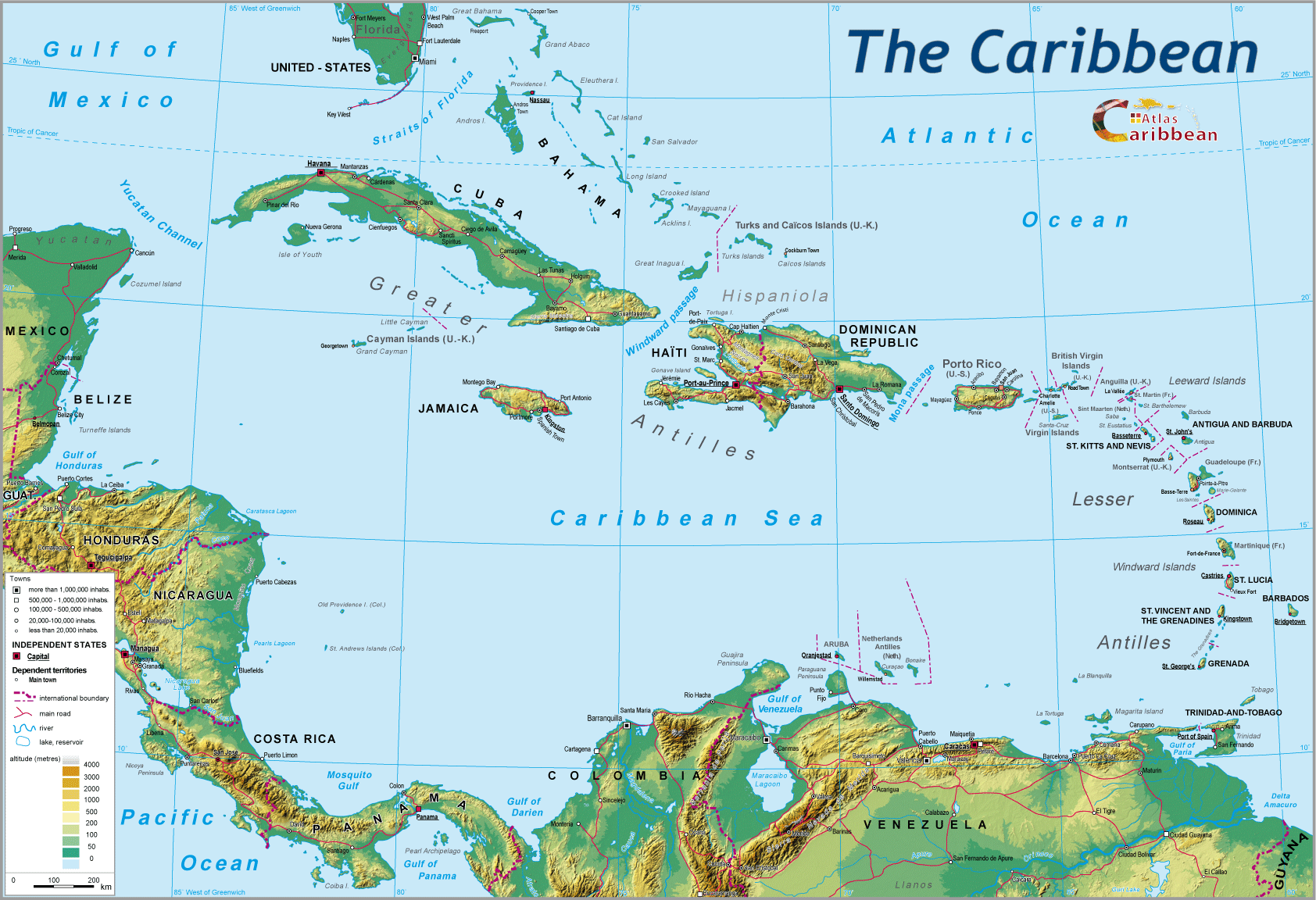
However, this dominantly physical definition, simple (overly so?) and appealing to the senses has had to come to terms with another historically and culturally based logic, reiterated in the Margarita Declaration:4 “We recognise that the cultural heritage of the Greater Caribbean is a powerful unifying force.” In this context, the Guyanas (effectively “mainland islands”), the Bahamas, the Turks and Caicos and their respective maritime domains, become an integral part of the regional boundary. The regional maritime space, referred to here as “Caribbean maritime space” or even “Caribbean maritime domain,” accordingly includes the Caribbean Sea sensu stricto, the Gulf of Mexico, and a vast Atlantic aureole, which stretches from Florida to the Guyanas.
The boundary limits of Caribbean maritime space

These boundaries, adopted in 1983 as part of regional agreements on the protection of the environment,5 are today a matter of general consensus.
However, if for the regional the sea remains a powerful unifying element, it is also a source of division, break-up, disintegration, and of both time-distance and distance-cost ruptures. The latter are exacerbated when a physical division is paralleled, as is often the case, by a political boundary and its whole train of different legislations, controls, formalities, taxes and occasionally, even suspicions. More specifically across the island Caribbean, the sea has helped shape, sometimes over very short distances, endlessly subtle variation in local identities. As many as there are islands, there are equally strong identities: Marie-Galante, La Desirade or Les Saintes, despite their proximity to the Guadeloupian mainland, their history in common with Guadeloupe, their membership of the same political grouping, they are not Guadeloupe. Secessionist aspirations remain strong in Nevis vis-à-vis very nearby St. Kitts.
Seemingly in contradiction islands, in their defence of the “small,” are almost always the instigators and initiators of region-wide organizations and structures, and are the most demanding when it comes to cooperation, by virtue of the principle “strength in unity.” At the same time, as recognized geographical entities, sufficient in their own right, it is not in their very nature to federate, to see their identity diluted within larger groupings, or to renounce even the smallest part of what they consider as the very essence of their identity. Any move towards more readiness of mind, for “a breath of fresh air” must juggle with the whole culture of identity politics, and even navel-gazing. Examples of instability and the centrifugal tendencies, which undermine the stability of many archipelagic states in the world, can be seen here.6
Over recent centuries, the stakes relating to the sea have fundamentally changed (see Issues at stake, international law, and regional relations). Today, the sea is at the centre of numerous regional issues: trade and commerce, tourism, environment, prediction and prevention of selected natural hazards, natural resources, illegal trafficking, amongst others. In all these areas, the sea is at one and the same time, in respect of bordering states and territories, a zone of collaboration and cooperation (see Regional maritime policies), as well as one of tension and conflict (see Multiple low level disputes).
1 Association of Caribbean States (ACS).
2Preamble to the Cartagena Convention leading for the establishment of the ACS.
3 Extract from the address by Madame Mirlande Manigat at the 4th meeting of Rectors and Presidents of Caribbean Universities held at the Karibe Convention Center, Thursday, 29 June 2006. Madame Manigat is responsible for international relations at the University of Quisqueya.
4 Article 12 of the final report of the 3rd Summit meeting of the heads of member states and government of the ACS, devoted to the theme of “the consolidation of the Greater Caribbean,” 11-12 December, 2001, Island of Margarita, state of Nueva Esparta, Venezuela.
5The zone to which the convention applies covers the marine environment of the Gulf of Mexico, the Caribbean Sea and adjacent parts of the Atlantic Ocean lying to the South of the line of latitude 30 North, and within a radius of 200 nautical miles, as measured from the Atlantic coasts of the states listed under Article 25 of the current agreement.
6For example, the Comoros, Philippines, Indonesia.
top
|
  |
© 2007-2025 University of Caen Normandy,
CERTIC, UMR CNRS 6590 ESO, AREC, Research and Studies Association on Caribbean area, All Rights Reserved.  |

