


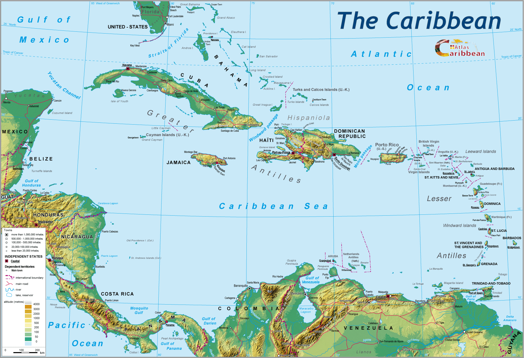
The stakes relating to maritime spaces have greatly evolved over time, and particularly during the 20th century. The ‘Law of the Sea' has had to adapt to this new reality. The Caribbean, for centuries the locus of an extraordinary confrontation between the great sea powers, has been at the heart of these changes, often playing a leading and precursory role. New stakes and new roles have had a profound effect on changing both the attitude and interest of states towards these maritime expanses and the influence bearing on their mutual relations. The implementation over recent decades of the Montego Bay Convention in respect of the complex geographical and political context of the Caribbean has given rise to a new situation.
1. From “Mare Liberum” to territorial control of the sea
Historically, two periods can be clearly identified.
1.1. Until the middle of the 20th century: ‘freedom of the seas,' law of the strongest, supra-regional stakes
During the whole of the colonial period, the primary preoccupation of the maritime powers, sometimes obsessively so, was to ensure the ‘freedom of the seas,' in other words, the secure passage of their own major maritime seaways. In first place were the routes that ensured the links with their possessions in the New World, and which permitted the extraction of their riches towards Europe. This freedom, occasionally guaranteed by Treaties, was more often ensured by naval military force and the control of strategic points of passage like straits. The British colonisation of Belize was aimed at controlling the Yucatan Straits. The huge fortress of Brimstone Hill on Nevis, with the evocative nickname ‘Gibraltar of the Antilles,' totally disproportionate to its island location, can be understood only in terms of this same logic of control over maritime routes. The same applies as well, in the 20th century, to the American bases charged with the security of the Panama Canal.1
Numerous wars between colonial powers, and battles, sometimes relentless against pirates, centred on the region in the name of this principle of ‘Mare Liberum.' Freedom, the exercise of which rested on the law of the strongest, i.e. the one able to ensure a balance in favour of one's own profit. In such a situation, the Caribbean was merely the theatre of war between powers from beyond it acting for foreign interests in the region. The sovereignty of the coastal states over the adjoining seas was thus limited to a narrow band just 3 miles wide (the range of a canon at the time). The actual existence of such “territorial waters” had never been either generally or officially recognised. This situation would continue, almost unchanged, until the middle of the 20th century.2
1.2. Since the mid-20th century: territorial control of the sea, international regulation, and regional stakes
Progressively, from the inter-war period onwards, the sea was no longer only seen as a place of passage and means of circulation, but rather in terms of its proper resources, as a separate economic stake in its own right. Thanks to technological progress, certain countries embark on the exploitation of submarine resource at ever increasing depths (oil especially... particularly in the Gulf of Mexico). Industrial and ocean going fishing develops (but admittedly only on a modest scale in the region), as well as the prospect of longer term mining of metallic nodules found on the sea floor at great depth.
The Caribbean has thus become a stake holding for those countries bordering it,3 as well as a regional stake, hence the interest in controlling the whole maritime expanse itself. At the same time (since the beginning of the 20th century), its role as an interconnecting, international thoroughfare found itself greatly enhanced and transformed by the opining of the Panama Canal. From ‘cul-de-sac' for exclusively trans-Atlantic trade, the Caribbean becomes the hubs of a major Pacific-Atlantic maritime seaway, the importance of which would only grow with globalisation, the dependence of the world economy on maritime transport, and the spectacular rise of Asia as an economic power.
These trends, varying in their impact and importance, stirred a general coveting of these stretches of sea, multiplying the motives for litigation and points of conflict. In the absence of any rulebook, the development of a “customary law of the sea” during the period from 1950 to 1970 proves both partial and uncoordinated. Some states unilaterally extend their territorial waters to 12 miles, and award themselves an Exclusive Economic Zone (EEZ) of up to 200 miles. The need for an internationally accepted way forward took shape to put an end to this situation of “no law” which existed across the quasi-totality of the world's oceans, and to create an “international law of the sea,” as worldwide as possible, resting on a clear set of rules agreed by all parties. The objective was to resolve those existing disputes and to avoid any new ones. The latter would be the subject of several world conferences, notably those of Geneva (1958), and particularly Montego Bay and Jamaica (1982). Throughout this protracted period, the Caribbean region would frequently assume the role of precursor in the matter of questions relating to control of the seas and the law of the sea.
2. The Caribbean, pioneer region of the law of the sea
With the incursions of Europeans, the Caribbean becomes a testing ground for exerting power and sovereignty linked to the sea. The Treaty of Tordesillas imposed on both the Spanish and Portuguese in 1494 by Pope Alexander VI, divided the New World between the two colonisers so as to avoid resorting to conflict, the partition relating to both land and sea.
The Treaty of Tordesillas (1494)
The line of division retained was the meridian located at 100 leagues, subsequently 370 leagues (approximately 1 770 km) to the West of the Cape Verde Islands (the meridian which today lies at 46° 37' West). All territories discovered to the West would belong to Spain and those to the East, to Portugal.

In effect, given that these new lands were as yet little known, and the division at best approximative, this Treaty in theory awarded Spain the whole of the Americas. However, when Pedro Alvares Cabral discovered Brazil in 1500, its eastern portion was attributed to Portugal. This Treaty was very badly received by the other great maritime powers like France, Britain and Holland, as it deprived them of the riches of the New World. The King of France, Francis 1st, demanded to see the clause in Adam's testament that excluded him from this share-out.
During the 17th century, when the Dutchman Grotius4 published what may be considered as the very first Treaty in Maritime law, formalizing the principle of “Freedom of the Seas,” his own country, a major maritime power, is already embroiled in multiple conflicts stemming from commercial disputes in the Baltic Sea, the East Indies (with the Portuguese), but above all in the Caribbean (with the British). During the decades of the 20th century, offshore oil prospecting and exploitation gets underway in the Gulf of Mexico and immediately confronts the problems of ownership of resources on the seabed. A the beginning of the 1930s, the discovery of the probable presence of major, easily exploited oil fields near Trinidad and Tobago, led to signed agreements on 26th February 1942, after 6 years of negotiation, between Venezuela and the United Kingdom (at that time the colonial power in Trinidad and Tobago) of the first bi-lateral accord in respect of a maritime delimitation. It is in Jamaica, at Montego Bay, that the first International Conference on the Law of the Sea was held in 1982. The final Convention (taking effect in 1994) retrospectively includes previous agreements but also introduces important innovations (see below), and gives birth to the current international law of the sea... but which obviously only applies to those states which both signed and ratified the Convention.
Countries having signed and ratified the Montego Bay Convention (as of 2008)

It is also in Jamaica, at Kingston, that the International Seabed Authority, the intergovernmental organisation charged with its application, would be established. In 1983, in line with the recommendations of Montego Bay, the Caribbean becomes the first region to produce a ‘Regional Convention for the Protection of the Marine Environment” (Carthage Convention), followed by related protocols, in particular the SPAW protocol (Specially Protected Areas and Wildlife) with its innovatory dispositions saving as a model for other world regions. Finally, in 1985, one of the first formal accords relating to fishing in the world was signed between Trinidad and Venezuela.5 The signing of the International Low of the Sea in 1982 at Montego Bay constituted the key step forward of the modern period. Its effects have impacted on the whole of the region, with both substantive and durable consequences.
Chronological list of ratifications and adhesions
| COUNTRY | DATE OF RATIFICATION OR ADHESION |
| Jamaica | 21 March 1983 |
| Mexico | 18 March 1983 |
| Belize | 13 August 1983 |
| Cuba | 15 August 1984 |
| Saint Lucia | 27 March 1985 |
| Trinidad and Tobago | 25 April 1986 |
| Antigua and Barbuda | 5 February 1989 |
| Grenada | 25 April 1991 |
| Dominica | 24 October 1991 |
| Costa Rica | 21 September 1992 |
| Saint Kitts and Nevis | 7 January 1993 |
| Saint Vincent & the Grenadines | 1 October 1993 |
| Honduras | 5 October 1993 |
| Barbados | 12 October 1993 |
| Guyana | 16 November 1993 |
| France | 11 April 1996 |
| Panama | 1 July 1996 |
| Haiti | 31 July 1996 |
| Guatemala | 11 February 1997 |
| European Union | 1 April 1998 |
| Suriname | 9 July 1998 |
| Nicaragua | 3 May 2000 |
| Dominican Republic | 10 July 2009 |
3. The Caribbean Maritime Puzzle
The generally applied extension since 1958 and particularly 1982 of territorial waters to 12 miles, the introduction of the new notions of Exclusive Economic Zones (EEZs), of archipelagic waters, of the rights of straits, of the continental shelf, have led on the one hand to an enormous extension of that maritime space which is controlled by states (some speak of the “territorialisation” of maritime waters)6 and, on the other hand, of a re-enforcement of the rights of states over the different component layers of the sea (surface, body of water, sea floor and sub-soil)… the nature and importance of such rights varying, depending on which zone (see: The protocol on pollution of Continental origin and the protocol on protection of wildlife).
Maritime space and international law

In a region boasting such particular and complex geographical and political configurations, these new developments have profoundly modified the usual reference points regarding the maritime domain, helping explain several specific features.
3.1. A wholly ‘territorialised” sea
Of relatively modest dimensions, enclosed by mainland and island territories, the Caribbean maritime domain is today almost totally7 partitioned into EEZs, and thereby appropriated by states.

The process of laying claim to expanses of sea found across the whole planet, here attains its ultimate stage: no international waters, no “high seas” (in the judicial sense) remain within the region. Through this national partition of Caribbean marine space, man has achieved what nature failed to put in place, at least for the island territories: to give them shared boundaries. He succeeded in creating numerous, new and occasionally surprising territorial juxtapositions, such as Colombia and Honduras, or France (Guadeloupe and Martinique) and Venezuela. Boundary questions, hitherto the prerogative of continental states, from now on would equally involve islands: problems of delimitation, of responsibilities linked to territorial extension of sovereignty (the prevision of, and the combat against pollution, control of illicit trafficking, etc.). The risks of conflicts and diplomatic tensions multiplied… but so too correlatively did the occasions for contacts, and the opportunity and need for cooperation and collaboration.
3.2. EEZs in competition
In this great endeavour to monopolise marine spaces, both large and small, states sought to establish their rights and assert their claims so as not to be disadvantaged by some quasi-irreversible partition. The multiplicity and proximity of states and territories have produced and continue still to cause particular problems, given that each EEZ stops where that of the neighbouring state begins! Within the archipelagos distances between neighbouring islands are always less (often greatly so) than 400 miles (i.e. twice the maximum extent of the EEZ). In such cases, the only guiding principle retained by the Montego Bay Convention to determine the respective EEZ limits is the geometric rule of equidistance, which at first sight appears straight forward and incontestable.
In reality, the complex configuration of coastlines, the innumerable islets, rocks, sandbanks only serves to confuse the situation, not least the often-delicate task of fixing the “baseline” against which all measurements are determined. In this “rush onto the sea,” the smallest land outcrop, previously set aside, may suddenly take on a quite disproportionate importance in respect of maritime rights attached to it by law. Its status, its sovereign attribution can sometimes give rise to disputes involving 4 to 5 states and territories. Generally speaking, regional EEZs (with two important exceptions) are, for reasons already mentioned above, of modest size, much smaller than their theoretical maximum, a situation which contrasts to that of the Pacific where the islands are much more distantly spaced. The disparities between Guatemala, denied access to the sea by the territorial waters of Honduras and Belize, and the immense EEZs of Colombia and Venezuela, are enormous. Haiti, hemmed in on all sides, is less well endowed than smaller but more isolated islands like the Bahamas, Turks and Caicos, or the Caymans. For the smallest islands, the territorial stake relative to their land area is most important. They see in the latter, like the frog in the fable, an extraordinary and unhoped-for inflation of their territory, thus of their own importance and international “visibility.” In turn, the large states (Colombia, Venezuela) consider their EEZs as the natural maritime extension of their powerful continental presence, a situation which underpins their status as regional powers. New rights, new duties: the coastal states, which have assumed proprietorship and sovereignty over the region's maritime space, must by the same token take on the shared responsibility. Everything that happens there is by definition within the remit of one or other state.
The sea weaves multiple ties between the states and peoples of the Caribbean, which are varied, complex, and contrasted. Meeting point of self-centred national interests, the product of competition, rivalry, even of strained relations (see: Multiple low level disputes), it is also the locus of shared heritage and identity, generator of multiple interdependencies and solidarities, the essential melting pot of a growth of awareness and regional construction (see: Both unifier and barrier, an ambivalent role). How can particular individual and wider regional interests be juggled and accommodated within the Caribbean's maritime space?
Maritime spaces and international law
The different zones as defined and generalised by the ‘Montego Bay Convention'
| ZONE (Terminology used) | DEFINITION AND CHARACTERISTICS | LEGAL REGIME |
| ‘Internal waters' | These are the waters lying between the shoreline and the baseline.* They include ports, harbours, roadsteads, estuaries... | Coastal state exercises full authority in all domains including controlling access. However, foreign civilian vessels have the right of free entry into ports (Geneva Convention 1923). |
| ‘Territorial Sea’ | Zone extends seaward from the baseline for a maximum distance of 12 miles offshore. | Coastal state exercises full sovereignty in this zone, as much over the body of water as on the sea floor above and below ground, as well as over the adjoining air space. However, foreign civilian and military vessels have “the right of innocent passage” which must not be “prejudicial to the peace, good order, and security of the coastal state.” |
| ‘Contiguous zone’ | Its width must not exceed a further 12 miles from the seaward limit of the territorial sea (i.e. 24 miles from the baseline). | This is an “intermediate” space in which the coastal state exercises only the “necessary controls” to prevent any infractions of its own laws and regulations in respect of customs, fiscal evasion, or immigration. Also included in the prevention of any removal of archaeological remains. |
| ‘Exclusive Economic Zone’ (EEZ) | Adjacent to the territorial sea, the EEZ extends to a maximum distance of 200 miles (370 km) seaward of the baseline. | The bordering state exercises sovereign rights “aimed at the exploration, exploitation, preservation, and management of both living and mineral resources within this zone.” These rights extend from the surface through the main body of water to the sea floor and beneath. They can be used to regulate fishing and, in particular, to fix quotas to the total catch. On the other hand, they apply neither to the freedom of sea and air navigation, nor to the laying of cables or canalisation by third party states. |
| ‘Continental Shelf’ |
This zone poses a problem of definition and hence of its delimitation.8 Its legally defined limit, complex and hardly satisfactory, takes a number of criteria into account: distance, bathymetry (depth), geomorphology and
sedimentology... but also any political considerations! Judicially speaking, every maritime state has access to the Continental shelf within the 200 mile limit (i.e. the EEZ), and if it
goes beyond that, in certain circumstances the EEZ could be extended to a maximum of 350 miles (from the baseline). |
Beyond the EEZ, a coastal state exercises rights only in respect of mineral resources both on and beneath the sea floor, as well as over sedentary live species. But the latter does not apply to adjacent bodies of water under the steward-ship of the same regulations as apply to the “high seas” (freedom of navigation, over-flight of fishing grounds, etc.). |
|
‘International waters’ or “high seas” |
Beyond the EEZ and the Continental shelf lie the international waters covering around two-thirds of the oceans. | With its World Heritage designation, it lies beyond the exercise of any king of national sovereignty. The principle of freedom prevails, of navigation; overheat flight, fishing, scientific research, etc. However, this freedom is limited by international decrees (protection of specific species, e.g. whales). The judicial regime, which applies, is that of the state whose ship’s flag is flown. Coastal states have the right of pursuit, only when the latter was initiated in a zone within that state’s sovereign jurisdiction. |
| SPECIAL CASES | ||
| “International Straits’ | Arm of the sea connecting two larger bodies of water | The Montego Bay Convention confirmed the pre-existing jurisdiction applicable to major straits. In the case of all vessels, it recognises the right of transit without hindrance or interruption. |
| ‘Archipelagic waters’ | Concept created for archipelagic states (i.e. those composed entirely of one or more archipelagos). Precise criteria have been established in order to delineate their baselines, so as to avoid any violations. | |
| ‘International seabed’ or “Area” | This refers to the deep seabed (abyssal floor) which lies beyond the Continental shelf. | Since Montego Bay, the “Area” has escaped all attempts of appropriation. It is a “common good” and must be utilised “for exclusively peaceful purposes in the interests of the whole of humanity.” Only the International Seabed Authority, representing states that are signatories to CLOS, can authorise any exploitation. |
* The “baseline” constitutes the limit between ‘internal waters' and the oceanic domain beyond: it serves as the point of reference for the delimitation of the different zones of the oceanic domain. Two methods are employed to determine the “baseline.” Firstly, by reference to the tidal low water mark, at least as far as it is indicated on large scale marine charts, and officially recognised by the coastal state. Secondly, by reference to a series of straight lines connecting the indented coastline or islands bordering any coast. The determination of these ‘baselines' is cardinal in that it acts as the start or base point for all measurements relating to the mapping of different maritime zones.
1 Today, they are no longer in use.
2 With the exception of the unilateral passage at 12 miles from the territorial waters of several states.
3 With the number of countries becoming ever greater, boosted by the successive independence of many small islands at the end of the century.
4 In his book ‘Mare Liberum' (Free Seas), the Dutchman Hugo Grotius considered the sea as international space that all states were at liberty to use for maritime commerce. It thereby underpinned an ideologically driven justification for the Dutch to break different commercial monopolies, thanks to its superior naval power. Britain, Holland's great rival in commerce would oppose this idea.
5 The third such accord, after the Franco-British accord of 1839 (Granville Bay) and the Franco-Canadian accord of 1972 (Saint Pierre and Miquelon): Philippe Fleury, “discontinuité et systèmes spatiaux, la combinaison ile/frontière,” Thèse, University of Caen, 2006.
6 André-Louis Sanguin, 1998.
7 With the exception of the tiny residual polygons in the ‘High Seas' located in the central area of the Gulf of Mexico.
8 Geographically, it is the submerged coastal border zone sloping gently under the sea as far as a sudden change in gradient marking the steeper descent of the ‘continental slope.' Geologically and tectonically, it is the immersed portion of the continent. For some states, it represents an immense area, whilst others have little or nothing to show. The legal definition adopted at Montego Bay was above all political!
top
|
  |
© 2007-2025 University of Caen Normandy,
CERTIC, UMR CNRS 6590 ESO, AREC, Research and Studies Association on Caribbean area, All Rights Reserved.  |

