


- Atlantic "Mediterraneans"
- Bassin Caraïbe : caractéristiques physiques FR ES
- Caraibe : problématique d'une région FR ES
- Caraïbe, Nord et Sud entremêlés FR ES
- From one resource to another
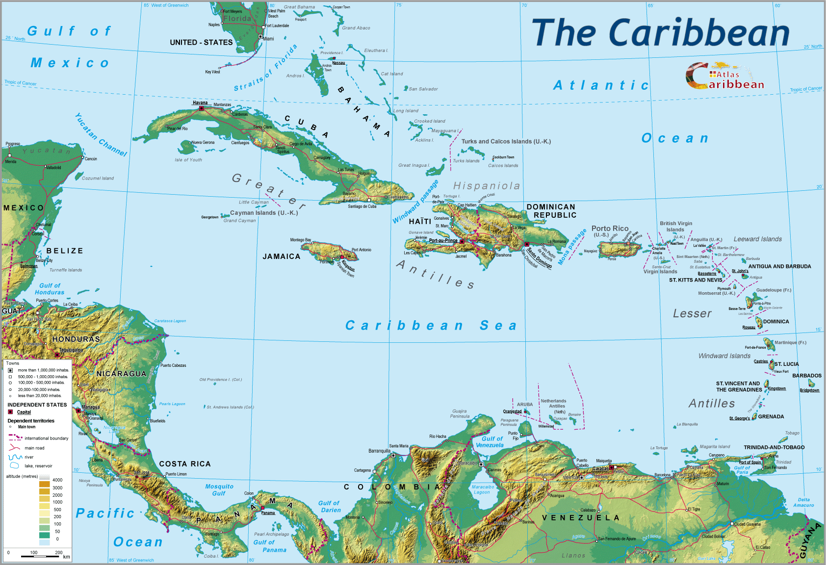
The slow but often violent earth movements that shaped the Caribbean Basin also gave it one of its essential characteristics: the fragmentation of its surface topography and its submarine depths. The latter contrasts with the vast level horizons of the North American continent, and of Patagonia to the south: it is due to the interplay of the tectonic plates which come into collision in this middle region. The configuration of the sea floor is closely linked to physical activity, often barely perceptible, which can brutally remind the local population that below the turquoise blue and smooth surface of the Caribbean, massive movements release huge quantities of energy, restructuring the submarine topography.
If the sea of the Gulf of Mexico and the eastern margin of the South American continent appear relatively shallow (80% less than 2 000 metres deep), here also is found the mass of alluvial sediments deposited by the Mississippi and Orinoco, and to a less extent the Amazon. The Caribbean Sea conceals a succession of deep trenches (up to 6 000 metres), submarine basins and encaised valleys following major lines of faulting.


Three structural components characterize the region: on its margins, the sandstone shield of the Guyanas, part of the old South American pre-Cambrian basement, with its relatively level surfaces interrupted here and there by hills. Only the edges of this basement plateau terminate in vertiginous escarpments. In front of the Guyanaen break-water, low level sedimentary formations have built up from alluvial deposits, erosion debris and coralline limestones. This essentially makes up Trinidad and Tobago, and Barbados.
To the west, Venezuela, Colombia, the isthmic countries and the Greater Antilles are the product of the powerful Andean progeny. This Andean complex comprises a succession of Cordilleras which diverge at different points. Along the isthmus, the Sierra Madre in the north and the Cordillera Central to the south form a mountainous ridge that stretches down most of Central America. The Pacific coast north of Panama is lined by a belt of more than 40 active volcanoes, several forming islands in Lake Nicaragua. Intermontane valleys and basins within the Cordilleras provide large fertile expanses of rich volcanic soil.
The third structural region is that of the Lesser Antilles, situated astride the zone of subduction of the Atlantic tectonic plate. This translates into a string of islands that emerged more than 25 million years ago, and whose formation continues today. Altitudes rarely attain more 1 500 metres, but abrupt changes in gradient give an impression of height. Apart from morphology, the sub-components of the Archipelago are divided into two main categories: high altitude islands and low-lying islands. However, it is not just altitude that underlies the division, but the proportion of the surface area taken up by mountains. Puerto Rico, whose summits never exceed 1 400 metres, is in the high altitude category, whereas the extensive plains and basins of Cuba place the island in the low-lying category, even though the cordilleras rise to between 2 700-3 000 metres. The same distinction applies to the Lesser Antilles between Dominica, Nevis and Montserrat, high volcanic blocs emerging out of the sea, as opposed to Guadeloupe displaying the flat horizons of the ‘Grande Terre,' or Saint Martin, deeply-eroded and whose very ancient volcanism has given way to the development of wooded, low-lying marshland and a succession of tombolas and sand-banks.
top
|
  |
© 2007-2025 University of Caen Normandy,
CERTIC, UMR CNRS 6590 ESO, AREC, Research and Studies Association on Caribbean area, All Rights Reserved.  |

