Caribbean space: a North South interface - Student
—
translation: Louis Shurmer-Smith
published on March 25, 2009
(2009)
Student document
The North/South interface
|
Problem statement |
Explanation |
Source |
|---|---|---|
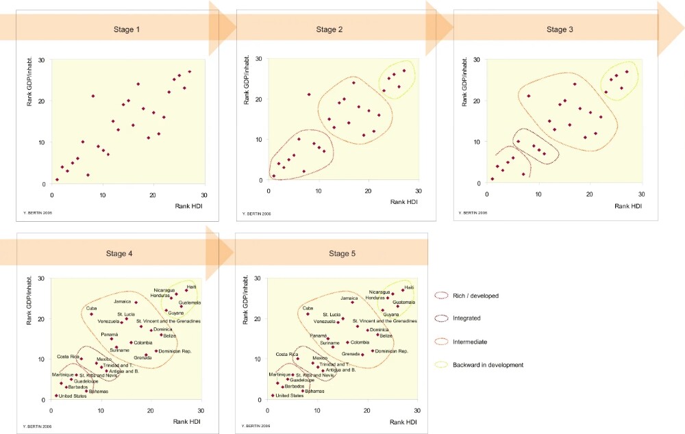
| Plotting the North-South divide across Caribbean space sometimes poses a problem, especially when using a large-scale map. Albeit little utilised until recently, statistical analysis accompanied by the use of graphs, and encompassing different development criteria, can assist in a better understanding of the North/South divide found within this fragmented space, where history and geopolitics have often introduced confusion into maps. | The graph that follows, produced by plotting a cluster of points, allows the reader to better visualise the existence of groups of countries with very different characteristics. Clearly, the final groupings proposed are subject to discussion. Note: Certain territories under trusteeship are not included in the graph because of a lack of available date (Puerto Rico, Anguilla, Montserrat...). | UN 2003. |
Note []
To cite this document:
Bertin, Y. (2009). Caribbean space: a North South interface - Student. Atlas Caraïbe.