


- Air Services in the Caribbean Basin: Continuity and Change
- Air transport (2007-2011): passengers & freight
- Communication technologies (2000)
- Espaces portuaires et maritimes FR
- Impact of containerisation on ports
- Kingston Freeport, port jamaïcain ou port chinois ? FR
- Les ports caribéens : reconfiguration de la géographie portuaire – 2019 FR
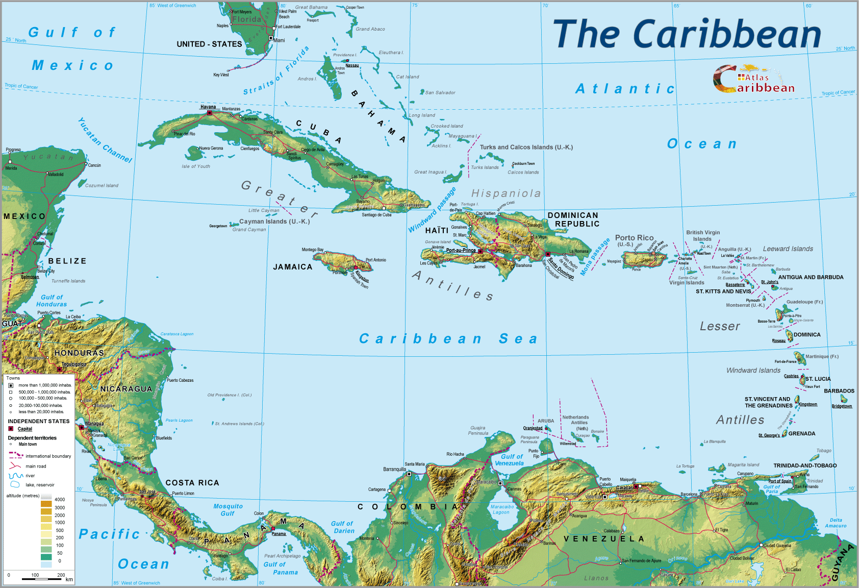
- Panama Canal
For the American continent, the problematic of trans-isthmian passage between Atlantic and Pacific facades is of long date. It stems from the physical configuration of this part of Central America comprising several narrow territories, some 100 to 200 km long, stretching between Mexico and the Gulf of Darien. It appears timely to revisit in general terms the successive historical contexts that would lead to the choice of the Panama isthmus at the end of the 19th century as the locus of a major project that remains a massif civil engineering achievement, as well as a key transit point in global maritime circulation. Today this canal, soon to celebrate its centenary, is both saturated by the number of ships wishing to use it; and at the same time avoided by a growing proportion of the world’s fleets whose ships exceed the permitted draught of the locks encountered along the waterway. For over 20 years, the debate has focussed on improvement transit through the canal, but without enlarging the size of the locks. After nearly a century of exclusive ownership by the United States, since 2000 the canal belongs to Panama, where it was built. In October 2006, this young republic presented a project to its population for the enlargement of the canal by constructing a third series of locks, a proposal approved by referendum with a large majority.
Prefaced by an historical reminder of the origins of this canal, and its near century of existence under United States tutelage, this paper examines the genesis of this colossal and costly undertaking prior to its construction, with reference to the competing alternatives offered by the overland North American railway links, without also forgetting in the medium and longer term the possibility of the future northwest sea passage around the Canadian Arctic Archipelago.
1. The slow genesis of a trans-isthmian maritime passage
1.1. The importance of the isthmus during the period of Spanish colonization
The geographical extent of the empire of Charles V meant that the Central American isthmus acted as the vital logistical connectivity hub draining the Spanish possessions in both the Americas and Asia. Goods from the latter, shipped in from the Philippines, came ashore at Acapulco, from there carried by mule train to Mexico to be officially checked before being moved back down to Vera Cruz on the Caribbean coast. The wealth originating from the Viceroyalty of Peru (Potosi) was unloaded at Panama before crossing the isthmus by mule and slaves as far as Portobelo which, in 1597, had replaced Nombre de Dios on the Caribbean coast.
Early on, English, Dutch, and French pirates attacked the Spanish galleons in the Caribbean Sea or where the latter exists via the Florida Strait. In order to defend themselves, The Spanish organized the “flota” into a protected convoy system, and fortified the main Caribbean ports of their colonies: Vera Cruz, Cartagena, Panama, Portobelo, Havana, San Juan de Puerto Rico, Santo Domingo.1
The idea of establishing a trans-isthmian waterway arose early on: from 1513 Balboa introduced the possibility of using the rivers of Darien to cross from one coast to the other; but knowledge of the terrain, geology, and climate was scant, technical means limited, and the subject local native peoples often hostile.
1.2. The upheavals of the 19th century
The decolonization of Spanish America dates from the beginning of the 19th century. In 1819, at the Congress of Angostura, General Bolivar proclaimed the independence of Greater Colombia. Fragile from the outset, this entity would break up some 10 years later into three new states: Ecuador, Venezuela, and New Grenada, which became Colombia in 1861, and included the province of Panama. Bolivar attempted to unify Central America around a number of United Provinces, later joined by Nicaragua in 1823 which would soon leave in 1839. Anarchy reigned across all these new states under the iron rule of their local ‘caudillos,’ with frontiers constantly contested (see the San Juan River between Nicaragua and Costa Rica).
This political instability hardly facilitated the promotion of a possible trans-isthmian canal by capitalist entrepreneurs disinclined to invest considerable sums on the basis of concessionary treaties that a new government could renege on.
Thanks to the writings and travel diaries of explorers and savants like Humboldt, Bonpland..., America was becoming better known. In 1811, in his Political Essay on New Spain, Humboldt described the four most likely route in his opinion for the establishment of an inter-ocean canal:
1. The Tehuantepec isthmus in Mexico
2. The Rio San Juan route via Lake Nicaragua
3. The Panama isthmus: Rio-Chagres-Panama
4. The Atrato via the Bay of Cupica

At the same time, Britain was a world power thanks to its naval supremacy, its industrial development, and the extent of its empire. It was interested in the Mesoamerican isthmus because the need to access its Indian territorial possessions and its Australian colony required long and perilous detours via Cape Horn and the Cape of Good Hope for its ships. Elsewhere, with the emancipation of Latin America, Britain Had acquired major economic holdings (mining, transport...) in the Andean countries (Peru, Chile).
Opposing Britain was the United States. After 1814 (the destruction of Washington by the British), the United States became suspicious of all European enterprise on the American continent. But first, it needed to control its own continental space.2 Following the Civil War (1865), the United States embarks on its push westwards. 1869 provides the key date in this objective, the completion of the trans-continental rail links. The United States now oversees two ocean facades. Frontier disputes with future Canada are quickly resolved. All that remained was the consolidation of its southern frontier juxtaposing an unstable Latin America. Now the geostrategic ambitions of the United States at the end of the century were maritime, as were those of the other imperial powers (Britain, Japan, France, Germany). In order to pursue its “gunboat diplomacy,” the United States required easy maritime passage from one coast to the other. Given the impracticability of the Northwest Passage around the great Arctic North, the Mesoamerican isthmus provided the only alternative, but where they would confront British ambitions.
In 1869, Ferdinand de Lesseps inaugurated the Suez Canal. It proved to be an extraordinary event, a civil engineering triumph born of the industrial revolution. So opened an era of achievement by ‘engineers’ who could apply their talents to breaching the Mesoamerican isthmus by canal, as they had done with Suez.
1.3. Through Nicaragua to reach the gold of California
The discovery of gold in this region in the middle of the century posed a major problem of access for prospectors coming from the West in search of the new Eldorado. Neither road nor rail links existed across the Rockies. The Vanderbilt family came up with a multi-modal solution to transport these gold prospectors, first by steamship, then rail, and even coach across the isthmus of Nicaragua, by way of the Rio San Juan and Lake Nicaragua. From 1848 to 1869, more than 150 000 passengers used this route managed by the Accessory Transit Company. Along it, many canal projects would be elaborated but none received financial support of any consequence. In addition, there remained serious gaps of knowledge regarding geomorphologic, geophysical, and hydrological data. Engineers, bankers and even ordinary adventurers were locked into a fierce geopolitical and geostrategic rivalry between the United States and Britain.3
The filibuster war of 1855-58 between Nicaragua (under the sea raider Walker) and its neighbours threatened this multi-modal communication link to Panama’s advantage. Here the Americans constructed the first trans-isthmian railway, which in 1856 to 1859 carried most of the migrants destined for the West coast of the United States.4
1.4. 1870-1903: the race to build an inter-oceanic canal – Nicaragua or the Panama isthmus?
1.4.1. The triumph of Lesseps at the Universal Congress of 1879
Two major logistical events served to re-launch the race for a canal link: the opening of the Suez Canal, which considerably shortened the sea route between Europe and Asia, and demonstrated the value of the technical progress thus far achieved, as well as the capabilities of Ferdinand de Lesseps and his team. The same year, the completion of the trans-continental railway across the United States now helps to exploit the ready access to the double ocean facade of this vast mainland territory. The connection between these two coastlines had proved excessively long by way of Cape Horn, and now necessitated a Suez equivalent route for the United States. Furthermore, any future trans-isthmian canal would need to be controlled by the United States, given the great political instability of the region.
In 1879, the Geographical Society of Paris organised a Universal Congress of the Inter-oceanic Canal, under the patronage of F. de Lesseps. Two projects were in contention: one supported by the United States, involving Nicaragua, and based on a proposed series of barrages along the Rio San Juan in order to better manage the waterway, combined with using Lake Nicaragua. The total cost of 65 million dollars appeared far too high. The project was taken up by Admiral Ammen who proposed a new route for the canal.
Led by F. de Lesseps, the French preferred the route across the isthmus of Panama, albeit a decision taken with little preliminary investigation, but with the accord of the Colombian government (the Roldan-Weyse Accord). The Congress voted in support of the de Lesseps project, its author still basking in the afterglow of his Suez venture. In 1880, the Universal Inter-oceanic Canal Company opened its offices in Panama, and launched a share subscription quickly fully taken up, which allowed construction of the canal to get underway. For 17 million dollars, the company bought up almost all the shares in the Panama Railway Company, a prosper enterprise destined to underpin the construction of the canal.
1.4.2. French failure
A large body of international literature exists which analyses the problems that arose. Suffice it here to recall the essential issues, because the causes of failure were many. The challenges confronting the project were clearly underestimated, because of the lack of preparation studies of the terrain being traversed in terms of its geomorphology and pedology, as well as inadequate climatic and hydrological data. All comparison between Suez and Panama had been entirely misplaced because of fundamental differences in both geology and climate. The equatorial Panamanian climate proved deadly for innumerable employees, most of whom were Caribbean French and English. The Company would submit its initial balance sheet in 1889, having dug out several kilometres of canal. In nine years, the Company had dug out more than 60 million square metres of earth, spent 88 million dollars in Paris, 166 million dollars in the isthmus, and suffered 6 300 deaths from malaria and yellow fever.
The Colombian government was unable to continue with the project because of lack of finance.
1.4.3. The choice by the United States between Nicaragua and Panama
In 1898, the war between the United States and Spain relating to Cuba, served to underline the urgency of a trans-isthmian waterway in order to ensure rapid connection between the two sides of the continent.5 Most of all, US geostrategic deliberations on this future canal came up against the Clayton-Bulwer Treaty of 1850, which guaranteed the neutrality of such a waterway. The US took advantage of Britain being pre-occupied in the difficult Boer War and unilaterally imposed the Hay-Pauncefote Treaty (November 1901), which awarded them the right to construct, control, and maintain all inter-oceanic canals constructed in Latin America, and without British participation.
Several projects remained in abeyance. In Mexico, the Tehuantepec isthmus offered the advantage of shortening maritime access between the two sides of North America. In 1894, three North American engineers constructed a railway link, but with a British firm hired to build a port on the Pacific coast (Sabina Cruz) as well as one on the Caribbean side (Puerto Mexico), and to manage the railway for half a century. Opened in 1907, this line was mostly used for local traffic, but transit usage remained insignificant.
The failure of de Lesseps in Panama had the effect of reviving the Nicaraguan project. In 1899, the American Congress authorised President McKinley to establish a commission (Isthmian Canal Commission) charged with the task of examining the two projects for Nicaragua and Panama. The former was submitted to Congress in 1899 for a total cost of 138 million dollars, involving a separate artificial canal so as to avoid the downstream section of the Rio San Jan. The Panamanian project was more expensive because the New Canal Company had redeemed for 40 million dollars the equipment, plans, maps, and archives of the defunct French company.
The US Commission appeared to be favouring the Nicaraguan project when in May 1902, the Mount Pelée catastrophe in Martinique tragically brought to the fore the weight of any hypothetical volcanic activity raised during the long debates on the Nicaraguan project, whilst this danger remained absent in Panama.6
However, in 1903, the Colombian Assembly opposed a treaty between Colombia and the United States, which constrained consideration of the Panamanian option. Contacts between the Panamanian separatist junta and a representative of the New Canal Company, which had been bought by the United States, reinforced by the activism of Bunau-Varilla, would lead on 3rd November 1903 to a separation of the province of Panama from the rest of Colombia. On the 18th November, 1903, the Hay-Bunau-Varilla Treaty awarded the United States full property rights over a band of territory 15 km wide across the Panama isthmus, in order to construct an inter-oceanic canal with lock gates. This extra-territorial status offered to the Canal Zone would leave its indelible imprint on relations between the United States and the young state of Panama.
1.4.4. A complicated construction site for a gigantic project
The Panama Canal would prove to be an extraordinary successful feat of civil engineering constructing by the military! The whole operation falls into two periods. The first, from 1903 to 1909, saw the changeover from the French to a consortium of American companies. The French failure offered useful lessons to their successors in respect of hydraulic works and the famous cutting of the Culebra trench, which constituted the most difficult obstacle encountered along the whole length of the route. But the consortium itself would also suffer its own financial difficulties and, from 1909, it was the state that would assume the dominant role. The 45th Engineering Corps would take control of the construction site, achieving the completion of the canal in August 1914, at the very moment World War I broke out in Europe.
The American engineers managed the environmental health of the whole construction site thanks to the teams of Dr. Gorgas, a military doctor specialised in tropical diseases. He established a causal link between the anopheles mosquito and the fever responsible for widespread deaths on the French site. He arranged for the swamps to be drained, the construction of ventilated buildings protected by mosquito nets. The site oversaw the excavation of 178 million cubic metres of earth, cost 387 million dollars, and several thousand deaths.
Henceforth, the destiny of the Canal and the Canal Zone would be intimately linked to the United States national military strategy. For a long time, the whole territory was administered by the US Secretary of Defence, and comprised vast military zones of which Southern Command became the most important military base outside the United States until the 1977 treaty. In effect, the Panama Canal was American, on US soil, but offering a new international waterway, except in time of war. The young state of Panama was born in difficult circumstances, totally dependent on a canal that it did not own.
2. Nearly a century old, a canal on the eve of its redevelopment
2.1. The 20th century: the persistence of rival projects for a canal primarily in the service of the United States
For the United States, the Panama Canal becomes the key to its southern flank geopolitical and geostrategic ambitions in its Caribbean “backyard.” The latter included all the Antillean islands, Central America, and the northern part of South America, including the Guyanas. Just prior to World War II, the US dominated the Caribbean Basin with the exception of the French Antillean and British West Indian colonies. A new project (project Sultan) for a trans-isthmian passage across Nicaragua was mooted, but soon forgotten with the onset of the depression and the first signs of the Second Word War. This refocuses attention on the strategic importance of the Canal Zone. The German submarine deployment in the Atlantic stretched as far as the Caribbean threatening the oil convoys from Trinidad, Aruba, and Curacao destined for Britain. Following the Mars 1941 agreement on lease-land, the United States decided to help Britain, and established major air-naval bases in the Bahamas, Barbados, and Trinidad under the control of southern Command located in the Canal Zone.
The ‘Cold War’ would push the US Command into considering new trans-isthmian routes, reviving old 19th century projects, but updated. The Nicaraguan option seemed to be the preferred way forward. It also served as a means of putting pressure on Panama, unhappy at having neither the ownership nor the totality of the toll revenues generated. Accordingly, following the armed conflicts of 1964 in Panama, there emerged a new canal project in Nicaragua, the ‘Pan Atomic Canal,’ whose construction required the use of nuclear explosives (project Plowshare)! Similarly, around 1970, the American Congress, alerted by the possible closure of the Suez Canal, re-launched consideration of new trans-isthmian canal projects.
The Carter-Torrijos Treaty of 1977 appeared to resolve the main issues in question between Panama and the United States. The treaty established a timetable for the progressive withdrawal of the US by the year 2000, and the transfer of the Canal and its zone to Panama. However, the whole agreement appeared to be compromised by the grave crisis involving both countries towards the end of the 1980s. The invasion of Nicaragua by American troops in 1989 marked the culmination of the extensive damage, and seriously affecting Canal through traffic. With great determination, the latter was fully restored from 1995 onwards. The new canal administration became “panamised,” it was the beginning of a new era, a significant event for this new republic which, as the creation of the Canal, without either ever owning or administering it, was at last going to achieve its proper destiny by assuming control of this vital cog in global maritime communication.
2.2. The Panama Canal – a saturated transit point, but recording increasing traffic
The year 1929 market the Canal’s first record of operation with some 7 300 crossings totalling a cargo traffic of 32 million tons. Mirroring the American economy this traffic was affected subsequently by the Great Depression, followed by the Second World War. The 1929 total was only achieved again in 1952. Thirty years later, a new record was established with 14 000 crossings totalling 185 million tons carried. The 1989 crisis would continue to impact on the total traffic until 1995. In 1996, total traffic touched the 200 000 tons mark with 13 720 transits. The latter total was now near the maximum capacity of the lock gates (14 000 transits) having levelled out during the last decade. The result was a slowing down in transit time from 23 hours in 1994 to nearly 33 hours in 1999. This was partly due to the growing size of ships using the Canal.7 So, despite the number of transits stagnating, the overall traffic in terms of tonnage carried increased by one third!
2.3. Growth in shipping traffic increasingly driven by trade from South-East Asia
For fifty years, the Panama Canal would play a primordial role in the trading exchanges between the two maritime facades of the United States. Several factors in turn would internationalise the trade in question, and the role of the Canal in the second half of the 20th century. The first, from the 1950s onwards, is due to the construction of the Federal Highway System, a network of intercontinental motorways whose strategic origin, in conjunction with the ‘Cold War,’ would support a huge growth and increased concentration on road transport between the two Pacific and Atlantic sides of the United States.
The second factor stems from the emergence of Asian economic power, having now become major players in international commerce. First it was Japan, then the Asian ‘tigers’ (Taiwan, Hong Kong, Singapore, South Korea). Finally, since 2000, the extraordinary growth of china, in effect the workshop of the world, and one of the United States’ principal trading partners.8
2.4. The largest vessels avoid Panama
Over the last 40 years, there has been an increase in the size of different types of vessel in order to respond to a massification in maritime transport. The closure of the Suez Canal for several years had obliged shipping companies to take the detour route around the Cape of Good Hope, who in turn sought some compensation by using bigger ore carriers and oil tankers. These vessels could no longer pass through the lock gate system of the Panama Canal (32.5 metres in width, 295 metres in length, drawing 12.5 metres of water). Since the 1990s , many shipping companies have built container ships exceeding Panamax norms. Currently, growth in maritime trade is primarily based on container and bulk carriers. Finally, the most recent super-sized cruise ships also exceed Panamax. As such, the lock gates of the Panama Canal constitute a veritable straitjacket, and insuperable for a growing proportion of the world’s fleets. In 1966, 90% of the latter would pass through the Panama Canal; by the end of the 1990s, the figure had dropped to barely 20%. At present, the Canal traffic is dominated by solid and liquid bulk (cereals, minerals, petroleum products) as well as containerised cargo. On the eve of the present century, oil tankers and bulk carriers accounted for 45% of the Canal crossings representing three-quarters of the total traffic; from 1990 to 1998, container traffic increased by a half.
2.5. The Canal’s mainland competitors
2.5.1. The limitations of isthmian land crossings
Across the Tehuantepec isthmus, the railway has been modernised. A motorway runs in parallel, but the container traffic remains limited. As for the other ferry projects for “dry canals” across Guatemala, Costa Rica or between Honduras and El Salvador, they are hardly on the agenda at level, which with the exception of Costa Rica are faced with serious socio-economic problems. In the case of the projected Nicaraguan canal, mooted during the Sandinista period, it seems to have been buried.
2.5.2. The limitations of US mainland crossings
The double-decked container trains which cross Canada and the United States between the Pacific and Atlantic coasts are used firstly for pre- and post forwarding and dispatch from North America’s coastal ports, with the balance taken up by real coast-to-coast transhipment relating to freight traffic between the Asiatic Pacific coast and the North American Atlantic ports, as well as for European ports. But the latter are increasingly serviced by routes using the Suez Canal.
3. A canal that has become truly Panamanian
3.1. An efficient transfer of power towards national control
The circumstances of the creation of the Republic of Panama, together with the handover of the Canal Zone to the United States in 1903, had left the Panamanians with a great sense of bitterness. Following serious conflicts between the two countries, the 1977 Treaty envisaged the eventual return of the Canal to Panama. This came about on 1st January 2000.
Since then, the Canal has been operated by the PCA (Panama Canal Authority). Since 1996, it has undertaken major improvements in order to speed up the transit of vessels by:
- computerising selected operations and improving traffic previsions;
- automating the Canal lock gate systems;
- increasing the number of tug boats from 17 to 24, as well as the number of locomotives required for manoeuvring passage through the lock gates (more than 100).
The narrow Calebra Cut has been widened to 200 metres, thereby allowing two Panamax ships to pass each other, and increasing by 20% the daily transit capacity, i.e. 44 vessels per day through the locks (around 16 000 transits per annum). The average transit time has again decreased to 25 hours. However, it is clear that the Canal is operating at quasi-full capacity (93%). It had become necessary to envisage further enlargement projects of a different order.
3.2. The expansion of the Panama Canal: the ‘Third Set of Locks Project’
In a referendum held on the 21st October 2006, the Panamanian population approved by a large majority a further enlargement of the Canal, which would become the largest construction site since it was first built. It would double the operational capacity of the Canal (i.e. more than 600 million tons) allowing it to respond to increases in its traffic over the coming 20 years. In any case, the existing Canal would remain saturated until 2015, and it was estimated that its through traffic would double over the next 20 years. It was intended that the construction project, inaugurated in 2007, would be completed by 2014 ready for its centenary celebrations. The work involved would not affect the existing traffic because the new lanes created would be separate alongside the present canal. The estimated total cost was around 5.25 billion dollars, which would be reimbursed by canal users in the medium term through an annual 3.5% rise in tolls and a loan of 2 billion dollars repayable in 8 years.9

The new construction project is centred on the building of a third set of lock complexes, one sited on the Pacific side to the southwest of the Miraflores locks, the other located to the east of the Gatun locks, on the Caribbean side. In addition, there will be new access channels, the widening and deepening of the existing navigation channel, as well as elevating the maximum operational level of Gatun Lake.10 The construction zone will mobilise 7 000 workers (45 000 during the construction of the Canal) and will require the shifting of 130 million cubic metres of earth. The capacity of Gatun Lake will be increased by 450 million litres without necessitating the construction of a new dam, nor the displacement of the present population. The overall project, designed by the Belgian company Cognes-Bellier (preferred to the bid submitted by the US Engineers Corps) is committed to safeguarding the areas of primary forest, its fauna, and archaeological sites.
The new lock-basins will each cover an area 427 metres in length, 55 metres in width, with a water displacement depth of 183, allowing the docking of vessels measuring 366 x 49 x 15 metres carrying 170 000 tons dead weight. The largest ships at present (12 000 TEU), and most bulk carriers and tankers will be able to pass through these new lock basins. The latter will also offer some new innovations as compared with those at present.11
3.3. The return of the Canal Zone: a trump canal for the Panamanian economy
The return of ownership to Panama of the Canal Zone is a major gain for the economic diversification of what represents the country’s vital development axis. In 1993, the Inter-oceanic Region Authority was created to plan and administer the 94 000 hectares comprising military bases, airports, schools, housing, hospitals, and ports. The first priority was to reinforce the port infrastructure at both ends of the Canal by strongly linking it in to the commercial role it already assumed for part of Latin America. In effect, the free-port zone of Colón (on the Caribbean side) is currently second in the world after Hong Kong. Across an area of 450 hectares, 1 600 firms undertake transit activities which generate more than 11 billion dollars of turnover. In scale, it acts as a veritable supermarket for the whole Latin American continent. This free-port zone, bursting with manufactured products originating above all from Asia, can only gain further from the through flow stemming from the container terminals located at the two ends of the canal. In ten of so years, the volume of traffic has quintupled, exceeding 2 million TEU per annum. To the South, Balboa disposes of 2 km of quays with 12 to 14 metres of draught. To the North, Cristobal is the largest Panamanian terminal with 2 500 metres quays equipped to accommodate all types of cargo, back by vast areas for container storage. These two ports are administered by the port consortium Hutchinson Ports Holding, one of the most powerful globally.
In the North, the terminals of Manzanillo and Colón have also been taken over by private consortia, an American storage operator in the first instance, and the Taiwanese shipping company, Evergreen, in the second, each terminal boasting a storage capacity of one million TEU. 12
These ports are linked to each other by a railway built in 1855; badly damaged by the military actions of 1989, it was reconstructed using standard gauge, with renovated rail stock, and put back into service from July 2001 for a cost of over 100 million dollars. In addition to the daily rail service’ which takes Panama residents to their places of work in Colón, the main use of this rail link resides in its role in the trans-shipment of containers.13 The daily traffic averages around to train journeys, but which could be’ increased to more than 30 by operating both day and night. Trans-shipment accounts for about 10% of the Canal’s container traffic, and allows the redistribution of Asian cargoes to numerous other Atlantic port destinations by way of Panamanian Caribbean terminals.
In addition to this trans-shipped traffic, these port terminal installations play a vital redistributive role regarding the half of the cargo collected in turn by Central American countries. Equally, an oil terminal located on each coast allows the transit of crude petroleum by pipeline.
Panama also assumes the role of a motorway hub following the investment of a billion dollars to transform the Pan-American Highway to four lanes along the 500 km linking Panama to Costa Rica. In short, the Canal is now matched by a veritable motorway.
All this economic activity is based on a secure banking network. Panama is Latin America’s top financial centre with 75 banks totalling several dozen billions of dollars on deposit.
3.4. The importance of United States’ interests remain
The Canal region annually attracts more than a million tourists of whom a number traverse the length of the waterway by cruise ship (more than 300 annually). Now stable politically, geographically removed from the main hurricane and earthquake zones, Panama is seeking to attract foreign residents, notably those retired.14 Residential housing projects (including a 395-metre tall tower block) have multiplied around Panama Bay, whilst the airport is the busiest in Latin America. Along the whole length of the Canal, private walled estates offer peace and quiet, security, and a cost of living below that of the United States, for it is from the latter country that the great majority of visitors and retired, as well as the major part of investments, originate.
3.5. The future Northwest Arctic sea-route: a competitor in the longer term?

During the 500 years since the 16th century, numerous explorers and seafarers have searched for this mythic route between Europe and the Orient, by way of a passage around the top of North America. The consequences of global warming have become increasingly marked across these high latitudes. Across the Arctic during the last 15 years, the ice-cap has seen its surface area decrease by 14%, and its thickness by 42%! This translates into the earlier onset of spring by 3 weeks, and a delayed end to the summer season. As a direct result, the Northwest Passage could remain open for several months a year from 2020, following the permanent contraction of the ice-sheet. This route could then become a navigable sea-way between Europe and Asia, saving in distance 7 600 km on the route via Panama, and 5 500 km via Suez.15 There would be no constraints on size of vessel, nor its draught, and some observers already dream of numbers of ships using this route by 2030.. the attraction becomes all the more appealing for the maritime transport industry given that the regions of the Arctic Archipelago are very rich in primary minerals, which would now become accessible.16
What will be the status of this future sea passage? For Canada, it is simply an internal waterway within their national waters, the control of which the states wishes to retain. Up until now, it has been the icebreakers of the Canadian army and coastguards that have this hitherto very little used sea passage, but three new icebreakers have been commissioned. Furthermore, Canada has decided to construct the first deep-water port in the Arctic of Nanisivik, Baffin Land.
As for the United States, should the Northwest Passage become a major seaway, article 37 of the Law of the Sea, in respect of international straits, would come into play. Possible litigation between the two countries is patently clear, to which may be added a boundary problem between Canada and Greenland, without forgetting recent Russian ambitions regarding the North Pole, seen as a physical extension of the Siberian continental shelf.
The enormous economic interests at play, linked to the prospects for energy and mining resources in this region, coupled with the maritime transport interests of a future international waterway, suggests a far from straight forward process in conflict resolution.
But when operational, will this new seaway seriously compete with the Panama Canal? Sceptics are still arguing over the pace of global warming, which nobody denies, but which appears more rapid at the poles. Certainly, the Northwest Passage will not be without hazards with floating ice blocks rendering the sea channel perilous for shipping. Such a passage would demand costly and continuous surveillance by icebreakers, as well as vessels designed and adapted to such waters (double-skinned hulls), and where all pollution would prove difficult to control and eliminate. In short, there would be a need to equip this sea passage with a complex and expensive security system for all navigation. Canada would, without doubt, require assistance, with the United States readily on hand, given their legacy of sophisticated listening stations left over from the Cold War in this region.
As such, it is still not possible to establish a credible timetable for this new sea passage. Taking account, on the one hand, of the rapid expansion in maritime trade of which the epicentre is China and, on the other, the completion of the projected enlargement and renovation of the Panama Canal, the latter should not experience any competition from the Northwest Passage for several decades. Along this future seaway, the flow of oil tankers, LNG (Liquefied Natural Gas) and mineral bulk carriers should grow as the hitherto mentioned wealth of the ocean floor sub-strata is accessed and exploited. Accordingly, the Northwest Passage will first act as a generator of traffic before becoming one of the sea straits vital to global maritime circulation in the second half of this century.
Coming up to its centenary, the Panama Canal is undergoing a dual transformation. Since 2000, it has become Panamanian, in the service of a country for which it represents the vital axis, both economically and socially. Built by the United States in a territory over which it acquired ownership, for more than 80 years this canal was operated to the advantage above all of its proprietor. The growth of global maritime traffic has increasingly led to internationalising the usage of this canal. The latter is now both saturated and too for the new generation of ships which have had to respond to the very strong growth of maritime trade generated by Asia, and particularly China. The new construction of a third set of locks, both wider and deeper, should respond to the transit needs of post-panamax vessels of all types.
Without doubt, the modernised canal will continue to face strong competition from routes utilising the Suez Canal, not forgetting the mainland, transcontinental ‘bridging links’ across North America, rival routes which together would leave Panama with only 5% of global maritime traffic. But the anticipated growth of the latter route in the decades to come in such that the opening of the Northwest Passage will not in itself marginalise the Panama Canal. This route appears destined to play an increasing role for Latin America hitherto so badly endowed with East-West mainland routes. Moreover, Panama’s re-appropriation of the former Canal Zone should allow it now to become strongly integrated into the country’s economy by using this axis to underpin progressive diversification. The importance of private capital, largely foreign, in local projects demonstrates one of the key aspects of the evolution of the canal’s during the past century.
From major pivot of the American strategy in the Caribbean Basin and its naval ambitions in the Atlantic and Pacific Oceans, the Canal now appears much more as a key element in a globalised geo-economy. Within this new order, the dominant actor remains the United States, whilst nevertheless having more and more to adjust to new power blocs like China, as well as the ambitions of a Latin America, which still dreams of freeing itself from under the powerful tutelage of the North. Ahead into the future, the Canal itself faces a dual destiny: to remain fully Panamanian whilst continuing to act as the preferred route in the complex global network of maritime connections.
1 In 1671, Panama was taken in a surprise land attack by the English pirate Henry Morgan. The town was pillaged and destroyed. Portobelo would be subjected to numerous attacks right through the 17th century.
2 Victory in the 1845-48 war against Mexico allowed the United States to acquire 40% of Mexican territory (the future states of California, Arizona, Utah, New Mexico, and Nevada).
3 In 1848, the British Navy bombarded the port of Greytown (San Juan del Norte) close to the estuary of the Rio San Juan. Since the 17th century, Britain hal largely controlled the eastern part of Honduras and Nicaragua (Mosquito’s region) as well as the eastern coast of Guatemala (future Belize).
4.In 1848, the Mallarino-Bidlack treaty between the United States and New Grenada afforded these two countries free passage via the isthmus of Panama. In 1850, the Clayton-Bulwer treaty between Britain and the US would prevent exclusive control by any one country of this future inter-oceanic route.
5 During this war, the battleship Oregon took 68 days from San Francisco to reach the area of hostilities in the Atlantic Ocean.
6 Bunau-Varilla, representing French interests, used this argument to the full in canvassing US parliamentarians.
7 For a small vessel, passing through the lock gates took around one hour, but one and a half hours for a large ship. In addition, before 2002, the Culebra Cut did not allow large ships to pass each other, hence the need for single file.
8 In 2006, of the 9 world ports whose traffic exceeds 200 million tons, six were Chinese. Chinese maritime trade grew by 40% between 2000 and 2003, a growth rate which has not slowed down.
9 From 2000 to 2006, the toll income to Panama totalled 1.82 billion dollars as opposed to 1.87 billion dollars transferred to Panama by the United States from 1914 to 1999! In 2007, the tolls collected exceeded 1 billion dollars.
10 The programme will restart the excavations initiated by the United States in 1939 aimed at enlarging the Canal, whilst envisaging a third set of locks, construction of which was halted by the tart of the World War II.
11 The locks will be closed by “rolling” instead of miter gates; vessels will be towed in by tugboats; 60% of the water required will be economised by the use of lateral water saving basins, linked to each lock chamber.
12 Under the ‘flag of convenience,’ Panama is the ‘home’ base for the world’s largest fleet, with 22% of total capacity, but comprising above all ships under American, Japanese, German, Greek, Norwegian, and Chinese ownership.
13 It takes 4 hours from one container storage site to the other (75 km) including tifting on/off trains. Each train of 35 wagons carries 70 containers, pulled by two powerful diesel locomotives of 3 000 CV each.
14 The rate of residential visas offered to retired applicants quadrupled in 2005.
15 Europe-Asia by cargo ship: via Panama, 23 300 km; via Suez, 21 200 km; via Northwest Passage, 15 700 km.
16 Several billion barrels of oil and hundreds of billions m3 of natural gas are estimated to exist under the Beaufort Sea, the Mackenzie Delta and Ellesmere Island. Also considered very probable are diamond beds in the Melville and Somerset Islands, and to the north of Baffin Land.
Bibliography
Essential reading: special issue of Acta Geographica, n° 121, 2000/1.
Contains full bibliography, see particularly articles by: P. Girot (p. 32-59, J. Marcadon (p. 81-96), J. Charlier (p. 102-111) et J.C. Lasserre (p. 112-122).
J.C. Victor, V. Raison, F. Tetart, Le dessous des cartes, Atlas géopolitique, Ed. Taillandia, 2005, p 236-239.
Magazines, newspapers :
La vie du Rail 2/1/2008 : "Panama : un train entre deux océans."
Challenges n° 52 du 19/10/2006 : "Panama : le dream des retraités américains."
Le Figaro Magazine du 20/01/2007 : "Panama, le canal des géants."
Le Monde 18/8/2006 : "Un chantier géant pour élargir le Canal de Panama."
Le Monde 18/9/2007 : "Arctique : un nouvel eldorado disputé."
Le Monde 2 1/12/2007 : "Une route sort des glaces."
Revue Diplomatique, sept-oct. 2006, "Panama, porte du Pacifique et pivot de l'Amérique", p 42-43.
Documentation of ACP (Autoridad del Canal de Panama) 2005 : "The new Panama Canal : a better way to go."
Images économiques du monde 2005, 2006, 2007 .
top
|
  |
© 2007-2024 University of Caen Normandy,
CERTIC, UMR CNRS 6590 ESO, AREC, Research and Studies Association on Caribbean area, All Rights Reserved.  |

