


- Cyclones, une vulnérabilité très liée au développement FR ES
- Dérèglements climatiques et insularité FR ES
- La Soufrière de Saint-Vincent et les Grenadines FR
- Littoral des Petites Antilles (2007) FR
- Natural Hazards (1999)
- Natural Hazards (2011)
Natural hazards and development across the Caribbean archipelago

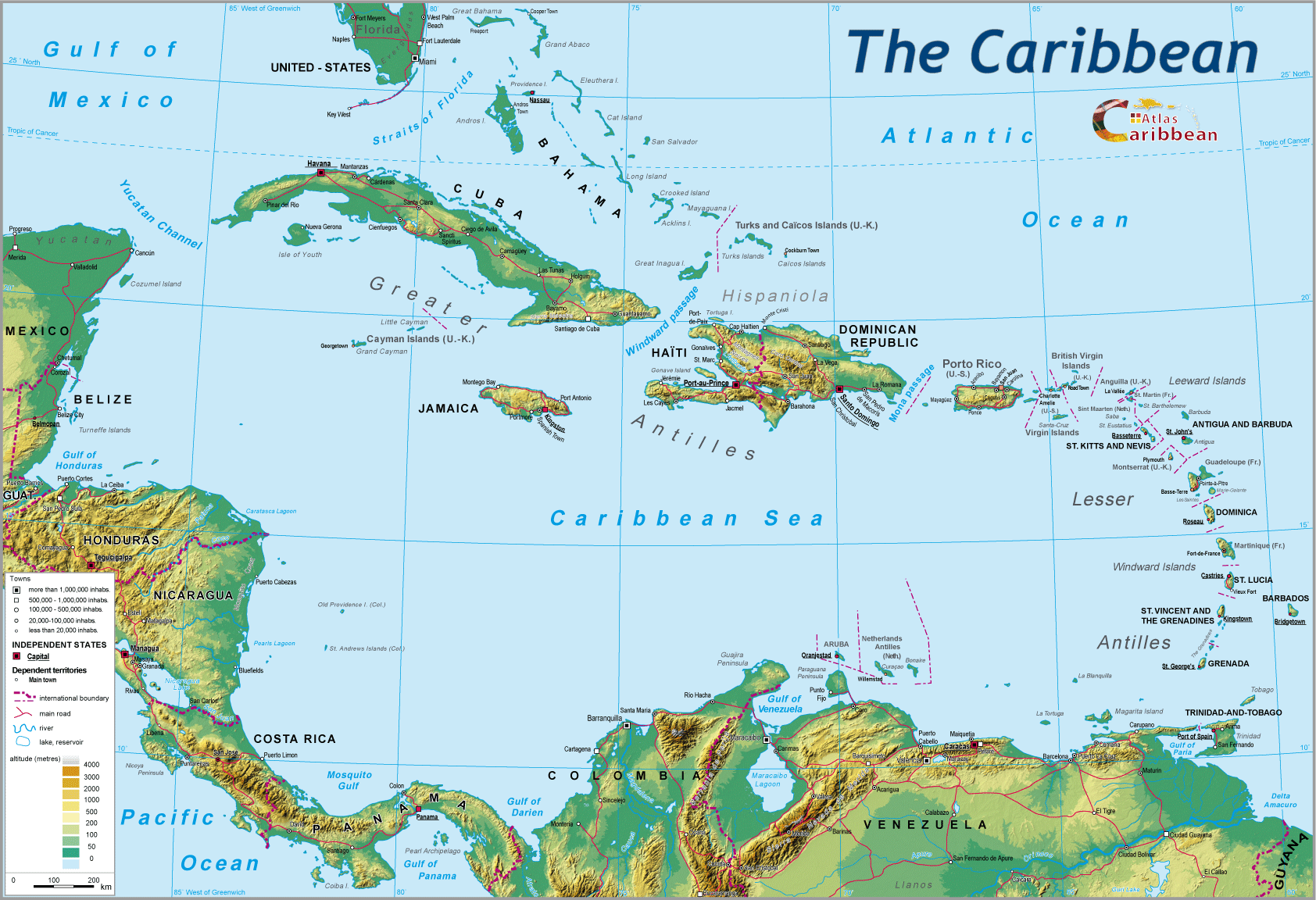
Over a distance of 2 000 km, the Caribbean island are links the two (sub-) continents of North and South America. In common with most other such island rims, this inter-tropical space is regularly subjected to brutal natural forces.
Once unleashed, they bring to this highly the densely populated zone widespread material and human losses. The atmospheric and tectonic context of the archipelago thus represents a serious handicap in terms of regional development. Even within the Caribbean, the geographical distribution of such catastrophic events is irregular. Is this unequal regional impact yet another dimension to be added to political and economic factors? The Caribbean archipelago was born of clash between tectonic forces lying within the terrestrial surface of the planet. Three main categories of catastrophe impact on this archipelago, populated by 34 million inhabitants: cyclonic, volcanic, and seismic. Equally, the latter generate their own indirect effects, whether specific or general (ocean surges, mudflows, landslips, flooding).
Three island groups may be identified:
- - A ‘hyperactive’ zone which includes the central Lesser Antilles (northern islands), Guadeloupe, Dominica, Martinique, Saint Lucia, Saint Vincent. Between 1900 and 1989, these islands suffered at least 3 disasters and 2 major hurricanes. The worst affected are was Guadeloupe which lived through 9 hurricanes and 7 major terrestrial disasters. This group of islands contains the active volcanoes of the Caribbean archipelago (Mount Pelée, Soufrière of Guadeloupe, Saint Vincent and Montserrat).
- - A ‘moderately active’ zone which corresponds to the Greater Antilles: during the same period these islands experienced at least 8 hurricanes, but nor more than one major terrestrial catastrophe. The case of Cuba is somewhat special, as the “Great Island” experienced no volcanic eruption nor any seismic activity. However, it has had to confront 26 hurricanes. The higher frequency of recorded hurricanes is due to the large surface areas of the territories in question, and their greater likelihood of being affected by such events.
- - The unaffected ‘spared’ zones: no terrestrial disasters during the 89 years and few catastrophic cyclones given the very low latitudes of these islands, a group that includes Grenada, Trinidad and Tobago, Barbados, Aruba, Bonaire, and Curacao.
Establishing a geographical and schematic synthesis of the distribution of these disasters in relation to their regional context thus becomes possible. A preliminary approach eliminates the less severe events, such as tropical storms, but which can prove devastating (Dorothy in 1970 across Martinique) because of heavy rains and site effects.
The occurrence of such natural disasters underlines the weakly developed infrastructure of the Caribbean states affected. The capacity to respond clearly varies according to level of development: the reduced ability for effective intervention and prevention is confirmed by comparing the balance-sheets of the resulting greatly excessive material and human losses. The passage of hurricane Gordon across Haiti in 1994 resulted in 829 victims, whilst the same meteorological event in Florida was the cause of only 2 deaths. Such statistical outcomes can thereby constitute an indicator of level of development.
Elsewhere, the end of the 1990s was marked by a period of active cyclogenesis, particularly during the 1995 season. Between the 28th August and 28th September, 5 cyclonic perturbations arrived from the North Atlantic. Amongst them, 3 crossed the Antillian archipelago. In 1998, two major hurricanes, George and Mitch respectively struck the Antilles and Central America. Cyclonic storms provide the most common source of danger. However, volcanic activity, albeit more rare in its frequency, should not be disregarded. 1997 saw the eruption of the Soufrière Hills volcano of Montserrat, forcing the exodus (to neighbouring islands, Great Britain...) of a large part of the population. The frequent occurrence of natural disasters demands the taking of bold and fundamental decisions with regard to regional planning and prevention strategies. Progress to date varies considerably from one island to another.

Some key dates (1975-1990):
- 1976: Phreatic eruption of the Soufrière (Guadeloupe)
- 1979: Magnetic eruption of the Soufriere (Saint Vincent)
- 1985: Seismic activity felt in Guadeloupe (magnitude 5), light damage
To find out more:
R. Madriaga, G. Perrier, Les tremblements de terre, Presses du CNRS, Paris, 1991.
H. Pascaline, J.J. Jérémie, Les volcans actifs des Petites Antilles, Université des Antilles et de la Guyane, 1985.
F. Pagney, Les ouragans tropicaux, CDDP Guadeloupe, Pointe-à-Pitre, 1994.
R.A. Pielke, The Hurricanes, Routledge, New York, 1990.
top
|
  |
© 2007-2024 University of Caen Normandy,
CERTIC, UMR CNRS 6590 ESO, AREC, Research and Studies Association on Caribbean area, All Rights Reserved.  |

